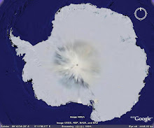
Larsemann Hills is at the Ingrid Christensen Coast of east Antarctic region (69O 24’ 28.8” S latitude and 76O 11’ 14.7” E longitude). It is named after Mr. Larsemann Christensen and is an ice-free coastal oasis at the Prydz Bay, located approximately midway between the eastern extremity of the Amery Ice Shelf and the southern boundary of the Vestfold Hills. The Prydz Bay represents an embayment along the Eastern Antarctic margin, lying between the East Longitudes 660 and 790. The Amery Ice Shelf on the southwestern side and Ingrid Christensen Coast on the southeastern end define its limits. The isolated islands, promontories, peninsulas and nunataks occurring along the continental ice describe the rocky terrain exposed in the area, which, from east to west, fall under Vestfold Hills, Rauer Group, Larsemann Hills and Bolingen Islands respectively.
There are two main peninsulas on the two extremities of the Larsemann Hills, namely the Broknes Peninsula and the Stornes Peninsula. In between these two peninsulas, there are number of islands of varying dimensions and some unnamed promontories. The northern and western sides of Larsemann are dotted by a series of small islands. The satellite imagery of the area indicates open sea on the eastern edge of the Broknes Peninsula. Westwards, the Clemence Fjord separates Broknes Peninsula from Stinear Peninsula and Fisher Island. The area north and westwards is marked by a number of islands, namely Harley, Easther, Breadloaf, Butler, Betts, McLeod, Jeason, Solomon, and Sandercock Island.
The area is marked by persistent, strong katabatic winds that blow from the north-east on most summer days. Daytime air temperatures from December to February at times exceed 4˚C, with the mean monthly temperature a little above 0˚C. The area generally remains snow free. Snow cover is generally deeper and more persistent on Stornes Peninsula than Broknes Peninsula and the present site.
There are several freshwater lakes ranging from small ephemeral ponds to large water bodies. Some of these water bodies are briefly ice-free or partially ice-free in the summer months. For the remainder of the year (8-10 months) they are covered with ~2 m of ice.
The highest elevation on Larsemann Hills is around 180 m above sea level. The hills are dissected by steep valleys lying between the ice sheet and the coast. The area is devoid of any higher organism and plants except for some sea bird, seals, penguins, algae, lichen and mosses.
Sunday, May 18, 2008
Thursday, May 15, 2008
ANTARCTICA
In the middle of the summer daylight
When the world glows by the sunlight.
Peeping out through the window
I could see the beauty of the shadow.
The gouging ‘Sastrugis’ flows
The colorful ‘Algae’ grows,
The sluggish ‘Seals’ are slow
While the gentle wind blow.
The mighty ‘Whales’ goes
Ignoring the unfriendly foes!
The careful mother nurture
Creating the child a future!
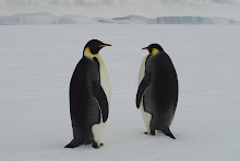
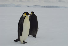
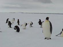
The black coated ‘Penguins’ crawls
Nourishing its chicks with Krill’s.
And the brown ‘Petrel’ flapping lower
I could see from the tower.
The summer sun goes down
The early ‘Skua’ will come at dawn.
If you run through the fallow
You’ll be followed by the shadow.
The stillness of this night
Was awakened by the whistling of the wind.
The harmony of this moonlight
Was aroused by the rattling of the ‘Blizzard’!
Lustrous stars are shining
Dazzling ‘auroras’ are glowing,
And the tired bodies relaxing
Though the darkness never ending.
But the courage that we have,
And the strength that we save,
The commitment that we gave,
Will unite the spirit of our brave!
All the icy deserts are dry,
All the ‘Nunataks’ are high.
And all the birds will fly,
But if you rely!
Antarctica will smile!
When the world glows by the sunlight.
Peeping out through the window
I could see the beauty of the shadow.
The gouging ‘Sastrugis’ flows
The colorful ‘Algae’ grows,
The sluggish ‘Seals’ are slow
While the gentle wind blow.
The mighty ‘Whales’ goes
Ignoring the unfriendly foes!
The careful mother nurture
Creating the child a future!
The black coated ‘Penguins’ crawls
Nourishing its chicks with Krill’s.
And the brown ‘Petrel’ flapping lower
I could see from the tower.
The summer sun goes down
The early ‘Skua’ will come at dawn.
If you run through the fallow
You’ll be followed by the shadow.
The stillness of this night
Was awakened by the whistling of the wind.
The harmony of this moonlight
Was aroused by the rattling of the ‘Blizzard’!
Lustrous stars are shining
Dazzling ‘auroras’ are glowing,
And the tired bodies relaxing
Though the darkness never ending.
But the courage that we have,
And the strength that we save,
The commitment that we gave,
Will unite the spirit of our brave!
All the icy deserts are dry,
All the ‘Nunataks’ are high.
And all the birds will fly,
But if you rely!
Antarctica will smile!
Sunday, May 11, 2008
WILL MAN MADE IMPACT BE FATAL IN ANTARCTICA?
Man has already proved that unchecked, unregulated exploitation of seals and whales have indirectly taken many other species of organisms to the endangered levels. This means, what constructive work nature did in millions of years, man was able to destroy just in couple of decades.
Today, with technological advancements, the danger to nature has grown to such an extent that man has been able to make estimates of minerals and oils, hidden by nature under the thick sheet of ice. If the mineral exploitation is permitted in Antarctica, it will not only load the environment with dust, it will also lead a large icy area to reduce its albedo. The reduce albedo will enhance melting of the ice sheets to such an extend that the sea level will rise more than 1 metre.
Today, with technological advancements, the danger to nature has grown to such an extent that man has been able to make estimates of minerals and oils, hidden by nature under the thick sheet of ice. If the mineral exploitation is permitted in Antarctica, it will not only load the environment with dust, it will also lead a large icy area to reduce its albedo. The reduce albedo will enhance melting of the ice sheets to such an extend that the sea level will rise more than 1 metre.
In fact, Antarctica is a fragile eco system of ice-air-ocean-energy, in which if one component is affected, all others will also be disturbed. Therefore, many countries try to protect Antarctic environment seriously, raise the issues of sovereignty, politics, logistical convenience, financial considerations, and the facilitation of scientific research. Environmental groups are, therefore, concerned about the scope of procedural and informational requirements for reviewing proposed projects and regulating development activities, especially in light of potentially large financial and political incentives associated with minerals development. Liability for environmental impacts from serious accidents is also an issue.
The way, world population is increasing, the hunger of the world for energy, food, water and other life support materials may modify the environmental treaty (Antarctic Treaty), in which, instead of maintaining pristine environment, only a practically clean environment may be maintained. This will be an extremely dangerous situation, as practically clean sampling and monitoring will not be feasible in such a harsh environment and thus the procedure will violate the treaties. The people who does not adhere to the protocols will be penalise and thus the conflict will erupt. Toady, the example at the world level is the pollution levels of various gaseous and solid pollutants in major cities which are often beyond the acceptable limits, yet nothing is done. Or many times, the monitoring approach remains only a paper work and nothing in reality is implemented. Often the monitoring and legal machinery is so corrupt that one is left to spoil the environment as much as one likes, just on the basis of economical power to grease the hands of these agencies.
If minerals development proceeds within the framework of the Minerals Convention, future debates will likely focus not on decision making procedures, but on the definitions of the Convention's many qualitative terms such as "adequate," "effective," "acceptable," "significant," "safe," etc. These terms can only be defined within the framework of scientific knowledge and uncertainties about Antarctica's environment.
Similarly, oil exploration, oil spillage from tankers, oil fires etc may deposit a thin film of crude oil seriously affecting the marine life and its entire dependent food chain. The third and the most critical factor which will affect Antarctica is the exploitation of Antarctic ice for meeting the need of world's drinking water for the growing population. As the world is witnessing the water shortage and the III world war to be fought for oil, water and food, will human start looking for pure, clean, ready to drink water from Antarctica? If so, who are responsible? Can we stop it? Or is it good to bottle water from Antarctica and serve it in the 5-Star Hotels?
Subscribe to:
Posts (Atom)
Mole Holes!

Weathering of rocks in Antarctica
Rock Weathering
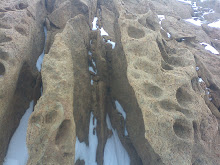
Larsemann Hills Rock Weathering
Hanging Rock
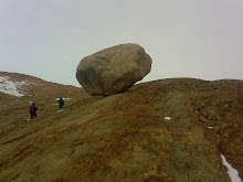
Hanging Rock Larsemann Hills and my friend behind it
Chooper
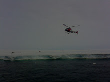
Chopper on duty
Algae
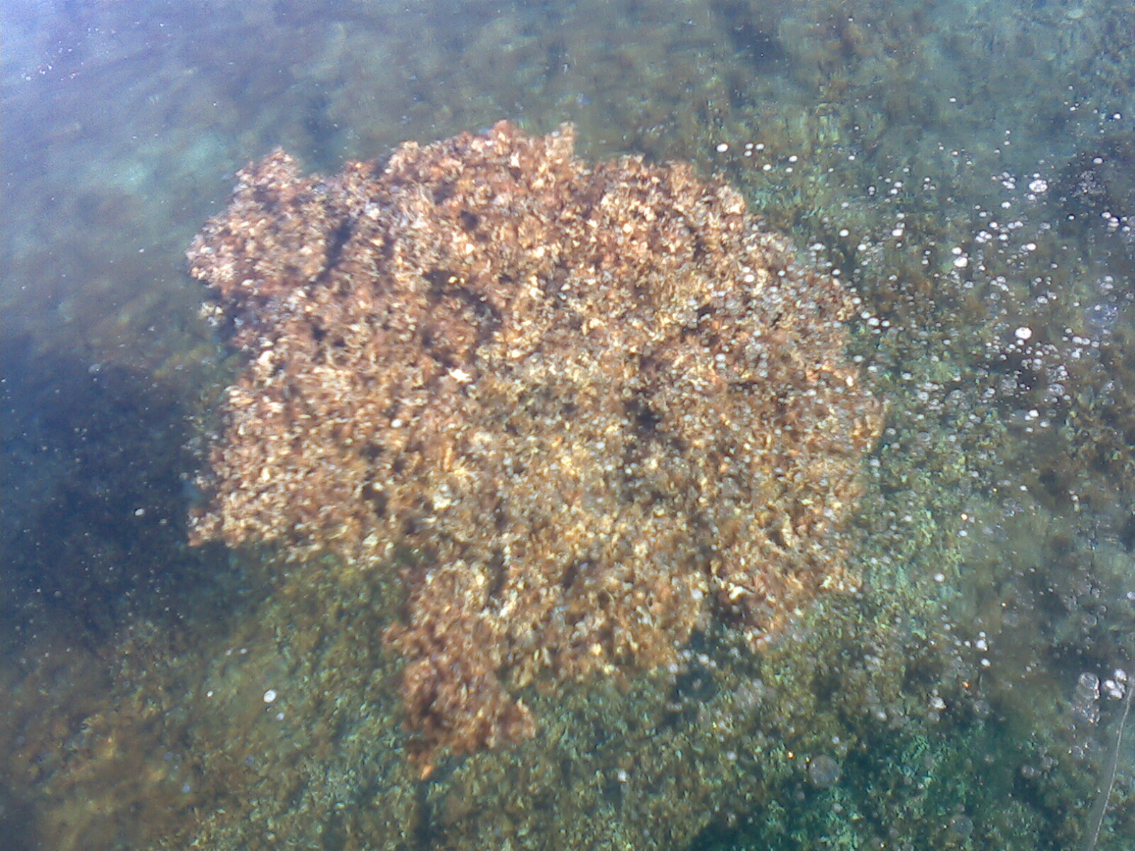
Antarctic Algal Mat
Pancake Ice
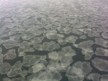
Antarctic Pancake Ice