Antarctica is known to be holding 75% of the total world’s fresh water in the form of 90% ice. To hold, this water in a healthy state of hygiene, it has a natural cooler, otherwise, water would have developed bacterial counts, much higher than probably, we can consume. Also, the loss of this water in the form of evaporation is compensated by the fresh snowfall, so that it maintains itself. The beauty of this fresh water is that, Antarctica is not holding this water in a deep well or pond or a pit or lake; it is on the top of gently increasing slopes of a huge dome. Probably nature has kept it in this fashion, so that man can use it, as and when required.
Antarctica is a gigantic freezer with its doors open to the southern hemisphere. Since its doors are open, it transports cold in the form of air out flowing from the interior of the continent to the periphery; water melted from polar cap ice and the shelf breaking in the form of ice bergs. The transport of cold is probably to keep the biological life in the Antarctic ocean as full of proteins , fat and fresh for consumption.
The biological reserve that has already been exploited by the man is the biological life in the ocean. Whales and seals were killed for various reasons and to such an extent that today, many nations had to declare them as "endangered species". Now, man has focused its attention on krill-the stock of food is very well known. The use of Antarctic bacteria for bio-sciences applications is another reserve.
Apart from these two apparent resources, it is the hidden resources which are now being looked at and as assessment is being made.
Antarctica is attaining great importance, as a possible source of minerals, oil, coal etc. However, at the moment, the exact resource potential and economics, may be the limiting factors, but with the technological advancements, days are not far off, when mining, off-shore oil drilling etc may be a reality in Antarctica.
Antarctica formed a part of the super Gondwana continent about 200 million years ago. Australia, India, Africa and South America were part of this Gondwana continent, which slowly drifted apart after Gondwana fragmented. Landmass of Antarctica, which covers an area of about 14.5 million sq kms, is about 3.2 to 3.6 billion years old, covered by rocks of relatively younger age of sedimentary, plutonic and of volcanic origin.
Therefore, since, India, Australia, South America and Africa have deposits of mineral wealth, it is therefore, believed that the Antarctic continent must have these deposits in large quantities, but here everything is underneath, the thick polar cap ice. In fact, it is the thick polar cap ice, which has restricted, the exact assessment and exploitation of minerals, but everyone is curious to know, what kind of deposits are there and what could be our share, if such an exploitation becomes, a reality.
Until 1970s, the expeditions were mainly for Scientific purposes, but with the ever increasing pressure of population, energy and economical needs of the countries, several nations have taken interest in Antarctica's mineral resources. Of course, the assessment of Antarctic mineral resources at the present stage is based on geological analogies and reconnaissance evidence.
The Antarctic Peninsula is easily accessible and thus has been studies, well. The modern technique of hydrocarbon resource assessment using sedimentary basin has suggested, petroleum potential of Antarctica. Oil is one of the minerals, which is going to attract many nations and the technology for off-shore oil drilling is not new to the world, and world, would see, its use even in Antarctica in the century. It has been estimated that 45,000 million barrels of oil and 115 trillion cubic feet of gas may lie, off shore the Antarctic coast.
Of course, while making any off-shore drilling, the natural gate keepers of Antarctica, technology will have to be developed to tame the natural gate keepers of Antarctica-the Ice-bergs.
Coal seems to be available in varying quantities and coal belts have been postulated under most of the east Antarctica's central ice sheet. It is believed that coal deposits many be around 11% of the total coal deposits of the whole world.
Among the other minerals, mica, quartz crystals, iron and many other ores are also available.
The exploitation of any particular mineral deposit in Antarctica will depend on its type, size and location, as well as, the environmental factors. At the moment, minerals of high value like gold, platinum, nickel, uranium will get the priority.
Although, mining at the moment is banned, United States environmental groups were the first to oppose the potential opening of mining and oil drilling in Antarctica, it has now been signed by all the member nations of the Antarctic treaty.
It is in fact the Antarctic treaty which has kept the continent free of conflicts, but the human pressure is increasing due to the scientific and tourist activities. The treaty bans mining in Antarctica for a minimum of 50 years and designates the whole continent and its dependent marine eco-system as a natural reserve devoted to peace and science.
Friday, July 25, 2008
Sunday, May 18, 2008
LARSEMANN HILLS OF EAST ANTARCTICA
Larsemann Hills is at the Ingrid Christensen Coast of east Antarctic region (69O 24’ 28.8” S latitude and 76O 11’ 14.7” E longitude). It is named after Mr. Larsemann Christensen and is an ice-free coastal oasis at the Prydz Bay, located approximately midway between the eastern extremity of the Amery Ice Shelf and the southern boundary of the Vestfold Hills. The Prydz Bay represents an embayment along the Eastern Antarctic margin, lying between the East Longitudes 660 and 790. The Amery Ice Shelf on the southwestern side and Ingrid Christensen Coast on the southeastern end define its limits. The isolated islands, promontories, peninsulas and nunataks occurring along the continental ice describe the rocky terrain exposed in the area, which, from east to west, fall under Vestfold Hills, Rauer Group, Larsemann Hills and Bolingen Islands respectively.
There are two main peninsulas on the two extremities of the Larsemann Hills, namely the Broknes Peninsula and the Stornes Peninsula. In between these two peninsulas, there are number of islands of varying dimensions and some unnamed promontories. The northern and western sides of Larsemann are dotted by a series of small islands. The satellite imagery of the area indicates open sea on the eastern edge of the Broknes Peninsula. Westwards, the Clemence Fjord separates Broknes Peninsula from Stinear Peninsula and Fisher Island. The area north and westwards is marked by a number of islands, namely Harley, Easther, Breadloaf, Butler, Betts, McLeod, Jeason, Solomon, and Sandercock Island.
The area is marked by persistent, strong katabatic winds that blow from the north-east on most summer days. Daytime air temperatures from December to February at times exceed 4˚C, with the mean monthly temperature a little above 0˚C. The area generally remains snow free. Snow cover is generally deeper and more persistent on Stornes Peninsula than Broknes Peninsula and the present site.
There are several freshwater lakes ranging from small ephemeral ponds to large water bodies. Some of these water bodies are briefly ice-free or partially ice-free in the summer months. For the remainder of the year (8-10 months) they are covered with ~2 m of ice.
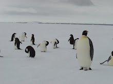
The highest elevation on Larsemann Hills is around 180 m above sea level. The hills are dissected by steep valleys lying between the ice sheet and the coast. The area is devoid of any higher organism and plants except for some sea bird, seals, penguins, algae, lichen and mosses.
There are two main peninsulas on the two extremities of the Larsemann Hills, namely the Broknes Peninsula and the Stornes Peninsula. In between these two peninsulas, there are number of islands of varying dimensions and some unnamed promontories. The northern and western sides of Larsemann are dotted by a series of small islands. The satellite imagery of the area indicates open sea on the eastern edge of the Broknes Peninsula. Westwards, the Clemence Fjord separates Broknes Peninsula from Stinear Peninsula and Fisher Island. The area north and westwards is marked by a number of islands, namely Harley, Easther, Breadloaf, Butler, Betts, McLeod, Jeason, Solomon, and Sandercock Island.
The area is marked by persistent, strong katabatic winds that blow from the north-east on most summer days. Daytime air temperatures from December to February at times exceed 4˚C, with the mean monthly temperature a little above 0˚C. The area generally remains snow free. Snow cover is generally deeper and more persistent on Stornes Peninsula than Broknes Peninsula and the present site.
There are several freshwater lakes ranging from small ephemeral ponds to large water bodies. Some of these water bodies are briefly ice-free or partially ice-free in the summer months. For the remainder of the year (8-10 months) they are covered with ~2 m of ice.
The highest elevation on Larsemann Hills is around 180 m above sea level. The hills are dissected by steep valleys lying between the ice sheet and the coast. The area is devoid of any higher organism and plants except for some sea bird, seals, penguins, algae, lichen and mosses.
Thursday, May 15, 2008
ANTARCTICA
In the middle of the summer daylight
When the world glows by the sunlight.
Peeping out through the window
I could see the beauty of the shadow.
The gouging ‘Sastrugis’ flows
The colorful ‘Algae’ grows,
The sluggish ‘Seals’ are slow
While the gentle wind blow.
The mighty ‘Whales’ goes
Ignoring the unfriendly foes!
The careful mother nurture
Creating the child a future!
The black coated ‘Penguins’ crawls
Nourishing its chicks with Krill’s.
And the brown ‘Petrel’ flapping lower
I could see from the tower.
The summer sun goes down
The early ‘Skua’ will come at dawn.
If you run through the fallow
You’ll be followed by the shadow.
The stillness of this night
Was awakened by the whistling of the wind.
The harmony of this moonlight
Was aroused by the rattling of the ‘Blizzard’!
Lustrous stars are shining
Dazzling ‘auroras’ are glowing,
And the tired bodies relaxing
Though the darkness never ending.
But the courage that we have,
And the strength that we save,
The commitment that we gave,
Will unite the spirit of our brave!
All the icy deserts are dry,
All the ‘Nunataks’ are high.
And all the birds will fly,
But if you rely!
Antarctica will smile!
Sunday, May 11, 2008
WILL MAN MADE IMPACT BE FATAL IN ANTARCTICA?
Man has already proved that unchecked, unregulated exploitation of seals and whales have indirectly taken many other species of organisms to the endangered levels. This means, what constructive work nature did in millions of years, man was able to destroy just in couple of decades.
Today, with technological advancements, the danger to nature has grown to such an extent that man has been able to make estimates of minerals and oils, hidden by nature under the thick sheet of ice. If the mineral exploitation is permitted in Antarctica, it will not only load the environment with dust, it will also lead a large icy area to reduce its albedo. The reduce albedo will enhance melting of the ice sheets to such an extend that the sea level will rise more than 1 metre.
Today, with technological advancements, the danger to nature has grown to such an extent that man has been able to make estimates of minerals and oils, hidden by nature under the thick sheet of ice. If the mineral exploitation is permitted in Antarctica, it will not only load the environment with dust, it will also lead a large icy area to reduce its albedo. The reduce albedo will enhance melting of the ice sheets to such an extend that the sea level will rise more than 1 metre.
In fact, Antarctica is a fragile eco system of ice-air-ocean-energy, in which if one component is affected, all others will also be disturbed. Therefore, many countries try to protect Antarctic environment seriously, raise the issues of sovereignty, politics, logistical convenience, financial considerations, and the facilitation of scientific research. Environmental groups are, therefore, concerned about the scope of procedural and informational requirements for reviewing proposed projects and regulating development activities, especially in light of potentially large financial and political incentives associated with minerals development. Liability for environmental impacts from serious accidents is also an issue.
The way, world population is increasing, the hunger of the world for energy, food, water and other life support materials may modify the environmental treaty (Antarctic Treaty), in which, instead of maintaining pristine environment, only a practically clean environment may be maintained. This will be an extremely dangerous situation, as practically clean sampling and monitoring will not be feasible in such a harsh environment and thus the procedure will violate the treaties. The people who does not adhere to the protocols will be penalise and thus the conflict will erupt. Toady, the example at the world level is the pollution levels of various gaseous and solid pollutants in major cities which are often beyond the acceptable limits, yet nothing is done. Or many times, the monitoring approach remains only a paper work and nothing in reality is implemented. Often the monitoring and legal machinery is so corrupt that one is left to spoil the environment as much as one likes, just on the basis of economical power to grease the hands of these agencies.
If minerals development proceeds within the framework of the Minerals Convention, future debates will likely focus not on decision making procedures, but on the definitions of the Convention's many qualitative terms such as "adequate," "effective," "acceptable," "significant," "safe," etc. These terms can only be defined within the framework of scientific knowledge and uncertainties about Antarctica's environment.
Similarly, oil exploration, oil spillage from tankers, oil fires etc may deposit a thin film of crude oil seriously affecting the marine life and its entire dependent food chain. The third and the most critical factor which will affect Antarctica is the exploitation of Antarctic ice for meeting the need of world's drinking water for the growing population. As the world is witnessing the water shortage and the III world war to be fought for oil, water and food, will human start looking for pure, clean, ready to drink water from Antarctica? If so, who are responsible? Can we stop it? Or is it good to bottle water from Antarctica and serve it in the 5-Star Hotels?
Tuesday, April 22, 2008

Monday, April 21, 2008
CONVECTIVE CURRENT DISPERSE MICROORGANISM: EAST ANTARCTICA
The Indian Antarctic station, Maitri is in the Schirmacher oasis of east Antarctica. The oasis is covered with snow/ice; except for the local summer season when it gets deglaciated and exposes the small hilly region. During summer, minute microorganisms are observed near water bodies of this rocky terrain. In the year 1996a monostatic acoustic sounder probed planetary boundary layer dynamics over this region. From the data it is observed that the thermal convection (both free and forced) persist for 5.63% of the time in the whole year. The occurrence of free convection predominates in the local summer season around midday, while sporadic cases of forced convection have been recorded during the autumn and winter seasons. The onset of convection is mainly at 0600 hrs to 1200 hrs, while the cessation period is limited within 1400 hrs to 1900 hrs. The cessation of convection is basically governed by the katabatic wind flow around the Schirmacher region and it indicates that the interior of Antarctica or the polar cap ice becomes cooler much faster than the rocky region of Schirmacher oasis.
Examples taken from the literatures on atmospheric structure and their effects on dispersal of microorganisms and their distribution by the wind are discussed. The study of monostatic acoustic sounder for thermal convections/plumes may form input for the study of dispersal, survival, metabolic activities and dispersion model of microorganisms. The application of convection/plume to aerobiology can also lead to improvements in forecasting, monitoring and understanding the various mechanisms of organism dispersal.
For further reading please refer:
Saturday, April 19, 2008
Land use and land cover changes Himalaya
Land use and land cover changes that occurred during the period from 1991 to 2001 in the Jahlma watershed of the Lahaul valley, a cold desert region of the northwestern Himalaya, were evaluated using land use data and visual interpretation of IRS Satellite imageries. The results revealed that out of the six major land use forms within the watershed, land areas under agriculture, kitchen garden and settlement land were found increased, whereas a declining trend was recorded in areas under grassland, barren land and Salix plantation. The cultivated land within the watershed increased from 54.87 % (total of agriculture land, kitchen garden, grassland, barren land, Salix plantation and residential area) in 1991 to 56.89 % in 2001, corresponding to an expansion of 4.41 ha. On the other hand, the areas of grassland decreased from 31.41 % in 1991 to 29.81 % in 2001. Such a dramatic land use and land cover changes taking place within the 33 km watershed area in a single decade clearly indicates the prevailing danger of land degradation and environmental deterioration in the region.
For further reading please refer:
For further reading please refer:
Aerosols behaviour: Northwestern Himalaya
Total suspended particulate (TSP) matter on fortnightly basis throughout the year and mass size distribution of aerosols as well as ultrafine aerosols on weekly basis in the months of May and June were monitored during 1996-2003 at different altitudinal locations of the Kullu-Manali tourist complex in the northwestern Himalaya. Concentration of TSP ranged from 35.8 (August 1996) to 207.3 µg m-3 (June 2003) at Mohal [1150 m from average sea level (ASL)] and from 31.7 (July 2003) to 239 µg m-3 (April 2001) at Manali (2050 m ASL). The mass size distribution of aerosols showed a bimodal distribution having one peak in the coarse size range (3.3-9 µm dia) and the other in the fine size range (0.08-2.1 µm dia) at both the locations. Ultrafine aerosol (UA) (0.001-0.1 µm radius) concentrations were found to be highest at the lowest experimental altitude site (Mohal) and vice versa. The diurnal variation of UA concentration for three years showed that the concentration ranges from 2640 (at 0500 hrs LT) to 5160 Number (N) cm-3 (at 1300 hrs LT) at Mohal and from 400 (at 0400 hrs LT) to 2190 N cm-3 (at 1300 hrs LT) at Kothi. On an average, TSP crossed its permissible limit set by National Ambient Air Quality Standard (NAAQS) level in the sensitive areas such as Kullu-Manali hill spots. Bimodal nature of mass size distribution indicates two important sources contributing in total aerosols—the fine mode, primarily due to anthropogenic activities and the coarse mode aerosols, mainly due to natural sources. Large number of concentration of ultrafine particles indicates the presence of air pollutants more at low altitudes as compared to high altitudes.
For Further reading please refer:
For Further reading please refer:
Himalaya: Increasing Aerosols
Total suspended particulate (TSP), size-separated atmospheric aerosols and aitken nuclei (AN) were monitored at Mohal (Kullu) and Manali tourist complex, in the northwestern part of the Himalayas from 1996 and onwards. Long-term trend analysis for TSP indicated a significant increase since January 1996 to December 2003 at Mohal (P<0.05) and at Manali there is no increase in the TSP level (P=0.9). The results indicate that the eight years average concentration of TSP at Mohal is 78.4 μg m−3 and 66.9 μg m−3 at Manali. Seasonal average shows that the TSP is highest during summer (Mohal 90.3 μg m−3, P=0.2; and Manali 74.1 μg m−3, P=0.5) followed by winter season (Mohal 84.3 μg m−3, P<0.05; and Manali 71.0 μg m−3, P=0.7). The mass size distribution of aerosols showed bimodal distribution having one peak in fine mode (0.08–2.1 μm) and the other in coarse mode (3.3–10 μm) at both the locations. The highest value of fine size separated aerosol showed the maximum values at 0.43 μm mode. AN (0.001–0.1 μm) density shows fine particles of air pollutants more at low altitude as compared to high altitude. The diurnal variation of AN showed maximum values between 1100 and 1400 h. The daily average concentration of AN at Mohal, Manali and Kothi was found to be 3990, 3200 and 1350 N cm−3, respectively. The increasing trend of TSP, high value of size separated aerosols in the fine mode and the peaking of fine particles during noontime are the indication of rising air pollution due to anthropogenic activities in this region.
For further reading:
Thursday, April 17, 2008
East Antarctic: Ecosystem
Based on the collections of vegetation from 14 sites by line transects in the Schirmacher oasis (SO) of east Antarctica, a total of 24 species consisting 12 species of lichens, 7 species of algae and 5 species of mosses were recorded. The algal flora consists mainly of phytoplanktonic groups dominated by blue green algae cyanobacteria such as Oscillatoria limosa and Phormidium fragile. Only one green alga (Chlorococcum) was found in the present transect study. Rare occurrence of green algae and dominance of blue green algae in the SO suggests that cyanobacterial species are better adapted to the prevailing extremities of climatic conditions of Antarctica. Bryum argenteum dominated the moss species and Acarospora gwynnii dominated the lichens. The plant community of the SO is heterogeneous in character, where none of the species approach 80-100% constancy, suggesting an unsuitable habitat for any species to occur homogeneously. The heterogeneity of vegetation can be linked to microenvironments of the oasis, which might have provided a little congenial condition for growth, both spatially and temporally during the austral summer. The estimated standing crop (dry weight) or biomass per square meter of SO varies from 6.25 to 45.31 g m-2 in various study sites and the average value is 22.5 g m-2.
For further reading please refer:
For further reading please refer:
East Antarctic: Organic Carbon and Enzyme
Schirmacher oasis (SO) (70°46'04''S to 70°44'24''S; 11°49'54''[+/-48]E to 11°26'03''[+/- 02]E), one of the smallest oases in Antarctica, is situated on Dronning Maud Land, which is about 70 km south of the Princess Astrid Coast of east Antarctica. This oasis is a small rocky moraine, surrounded by the vast polar ice cap and Antarctic ice shelf. It represents cold desert conditions, devoid of any higher plant and animal life, except for a few patches of microbiotic crusts in some suitable niches. Melted water from glaciers, ice and snow produces about 30 fresh water lakes and many streams, which supply essential nutrients to the autotrophs (algae, mosses and lichens). Between 30 December 1999 and 29 January 2000, soil samples were collected from 14 sparsely vegetated sites to study the soils and ecology over this oasis. Bio-physicochemical parameters, organic carbon and microbial activities (dehydrogenase) of the soils were determined. The average surface air temperature and wind velocities during the sampling period were -0.87°C and 4.3 m s(-1). The average pH, plant biomass (standing crops) and moisture content were 7.5, 22.5 g m(-2) and 375.4%. Total organic carbon (TOC) contents of the soil samples ranged from 1.16 to 2.58% and the mean value was 1.58%. Dehydrogenase activity (DHA) was low and the average was 0.008 mg Triphenyl formazan (TPF) g soil(-1) day(-1). The low DHA in SO suggests that anaerobic oxidation of organic C is poor. TOC and DHA are negatively correlated with plant biomass (r= -0.14, P= 0.62 and r = -0.21, P = 0.48). The organic C and microbial activities are dependent on the amount of the autotrophic productivity and abundances. TOC correlated significantly with DHA (r = 0.85, P less than 0.001), which indicates that organic C is an important factor in controlling the development of DHA in the SO. The averaged bio-physicochemical data in the oasis do not deviate much from the respective mean values and the TOC is expected to remain in the range of 1–2%; however, a small change in human activity is likely to cause long-term impacts in this pristine ecosystem.
For further reading please refer:
East Antarctic: FOG
An episode of fog during 8–9 January 1996 over the Schirmacher Oasis of East Antarctica was investigated. It revealed that the fog was formed due to advection of southeasterly winds by high moisturecontaining northwesterly winds, blowing from the ocean over the cold ice shelf, which leads to the condensation of moisture, thereby forming fog for a duration of about 24 h. A monostatic acoustic sodar recorded the episode, which revealed the thickness of fog layer up to an altitude of about 300 to 400 m. Supplementary meteorological and radiosonde data were utilized to understand the mechanisms of the formation and dissipation of advection fog in this region. Supporting literature illustrates that this type of fog is an important source of water for photosynthesis, growth, reproduction and other metabolic activities of the poikilohydric microbiotic crust inhabiting the cold, arid and dry ecosystem of the coastal East Antarctic oases.
For further reading please refer:
For further reading please refer:
Tuesday, April 1, 2008


ENVIRONMENT OF ANTARCTICA
We stand at the threshold of a major change in our approach to environmental issues Antarctica, the coldest and the windiest place in the world is now a source of endless concern and controversy. It is unique in every sphere and is a common heritage of all the human kind. Politically, it belongs to every country in the world. Biologically, it is the largest wildlife sanctuary on the earth. Ninety percent of the planet’s freshwater resource is located here. The continent is a critical component in the world’s weather system and an invaluable open-air laboratory for monitoring global atmosphere pollution. Antarctica is the only continent, which is virtually unspoiled by any anthropogenic action. Scientifically, Antarctica can be look as a unique open system of the earth, where all the life, geology, climate and water interact to each other over the millions of years, converge to produce a occurring pattern of changes that has profound effects on the regional and global environment. It is also a part of the planetary energy system, receiving from the Sun, undergoing changes, affecting life, oceans, atmosphere, climate, and sediments. In this energy system Antarctica plays as a heat sink. Energy flows continuously from the source (the Sun) to the Earth and to the sink (the Antarctica). Applying the laws of thermodynamics, all the energy received on Antarctica is conserve in the form of glacial ice. Therefore, 78 percent of the world’s glacial ice are locked here. In biological ways, it can also be seen as a vast single ‘ecosystem’, where the dynamic complex of all the endemic organisms and its local non-living environment interacts as a single functional unit. Hence, it is a unique system. "Biogeochemical cycle" or the movement or cycling of a chemical element or elements through the earth’s atmosphere, hydrosphere, lithosphere and biosphere plays a significant part in determining the bio-diversity of an area. In this cycles the biota plays a key role for exchanges of vital nutrients from one phase to another. Some of the micro-nutrients (carbon, hydrogen, oxygen, nitrogen, phosphorous, sulphur, calcium, potassium, iron and magnesium) that form the major building blocks of the organic compounds and which are required in large amounts by most forms of life are continually circulated by the organisms. In the case of Antarctica as there is very less diversity of flora and fauna this cycles are not so profound. Although, other related cycles which are performed by he non-living environment such as ‘the sedimentary cycle’, ‘the tectonic cycle’, ‘the hydrologic cycle’, ‘the rock cycle’ etc. are more or less pronounce in this continent. The weathering and erosion of nutrient rich rock from the Antarctic continent by the glacier and the wind activities makes Antarctic ocean to be the most nutrient rich ocean in the world. This makes the southern ocean to be the most biologically productive ocean in the world. Although, Antarctica has the harshest environment due to extremely low temperature (average –45o C) and high wind speed (average 100 km), the continent has been continually exploited by humans after the events of modern industrialization. During the early 19th century most of the biological resource and the tranquility of the continent has been disturbed by human beings either for commercial or scientific purposes. International interests on Antarctica began with commercial whaling and sealing expeditions through the 18th and the 19th centuries. Now Antarctica is no more isolated continent but a vast natural laboratory for humans. The fate of Antarctica is day by day at the mercy of human beings. Although industrialization has brought many benefits to human kind, the impact on the environment is never a positive one. As the world’s human population increases exponentially and the resources become scarcer everyday, the governments and businesses are looking to Antarctica for new supplies of food, freshwater and mineral wealth. The worldwide problems of malnutrition and protein deficiency further look forward to the exploitation of protein rich "krills" population in the Antarctica Ocean, which will further disturb the intricate Antarctic Ocean ecosystem. Impact of green house effect and global warming with the resulting affect of sea level rise due to melting of Antarctic ice are becoming more and more serious environmental issues today. The environmental health problems due to ozone depletion and the effect of harmful UV radiation are also a major concern now. Therefore, Antarctica has become a central consideration of human environment and is becoming one of the greatest environmental issues of the world.
THE FATE OF LOKTAK LAKE
Manipur the ‘Jewel of India’ or the ‘Switzerland of the East’ has so many peculiar features. Endemic plants, animals and scenic beauties regardless of any exaggeration, will always be pristine. The state which lies between the 230 80’ N - 250 68’ N and 930 03’ E - 940 78’ E at the North East extreme of India, nestling at an altitude of about 790 m above the mean sea level was guarded naturally by nine ranges of hills.
Although, Manipur is a small state (area = 22,327 Sq. Kms), the species endemism are surprising large. The climate, topography, and geographical conditions are somewhat different from the rest of the world, determining the large number of biological diversity in this state. Adding more to its beauty like a sparkling diamond amongst the pearls, a beautiful lake known as “Loktak Lake” shines at the center of the state. Loktak (LOK = stream + TAK = the end) is the journey end of several streams and rivers. It is also a pulsating lake, which is about 500 Sq. Kms during rainy season and 250 Sq. kms during winter and is proud to be the largest fresh water lake in the northeastern region of India. The cultural and the traditional aspects of Manipuris will never be completed without relating this lake, which has been witnessing the whole history from the beginning of the Manipuri civilization. “Moirang Kangleirol” among the various examples is still remembered till today.
This lake is inevitable to the communities of Manipur. Loktak Lake is becoming very important in terms of its socio economic value, environment, cultural, tourism, habitats of numerous waterfowls, plants, animals, fishes, its dynamic ecological system, potential natural resources etc. were all becoming indispensable to the people of not only Manipur, but also to the world. The first international concern of this lake was in the year 1990 in which “the Convention on Wetlands of International Importance” drafted at the Iranian City of ‘Ramsar’ (1971) gives full emphasis of the Loktak Lake for its peculiar characteristics. This convention simply known as “Ramsar Convention” thereby brings the Loktak Lake into the international status for its uniqueness and put into the limelight for its conservation and management Out of the 18,37,149 (as per 1991 census) populations of Manipur about 12 Lakhs people are directly or indirectly benefited from this lake. Foods, agriculture, irrigation, pisci-culture, energy, aesthetic and recreational values are exploited by the people since time immemorial. Thus, the exploitation of the various renewable and nonrenewable resources decides the socio-economic condition of the state. During the 1979 Manipur famine, the fruits of Trapa bispinosa/Trapa natans (Heikak) and Euryale ferox (Thangjing) were the only sources of livelihood for thousands of people. Just two decades back, the biodiversity of Loktak Lake was very rich in its floristic and faunistic value. However, today, the most important fauna of this lake, the Brow-antelered deer or Cervus eldi eldi (Sangai) is at the verge of extinction. Efforts are made by the government, voluntary organizations, and individuals to conserve this priceless deer species from extinction. In 1977 the Indian Board of Wildlife gave ‘Keibul Lamjao’ the status of a national park. A recent survey of the Loktak Lake revealed many of the undesirable factors, which we have been avoiding till today, either knowingly or unknowingly. An attempt to make the decision-makers aware about the fate of this lake has been put forward in this brief report. The major issues are as follows:
1. Waste products brought by the rivers
Nearly 29 to 30 rivers and streams feed Loktak Lake. ‘Ungamel Channel’ (Ithai Barrage) is the only outlet for this lake. The perennial rivers and streams, which flow into Loktak Lake, bring sediments every day in their course to the lake. Continuous soil erosion in the hilly terrain due to deforestation further enhances the process. The sediments deposit at the mouth of the rivers contributes to shallowing of the lake bottom. As most of the rivers flows in the heart or center of the cities and towns, the urban sewage dumped into these rivers ultimately reached the lake, whereby contributed in deteoriating the delicate ecosystem of the lake. Highly toxic substances such as insecticides, pesticides, oils, polythene bags, other non-biodegradable waste and municipal wastes further create a disastrous situation to the lake environment. “Nambul” river the most polluted river in Manipur ends up in this lake after depositing whatever possible pollutant it bring in its course. “Thongjaorok” or Bishnupur River on the other hand brought its entire sediments load, cause due to mass deforestation in the upper part of the hilly region of this river.
2. Soil erosion at Thanga Island
Today the face of “Thanga Island” has become scared by both natural and anthropogenic actions. Among the natural causes are the wind, waves, rainfall, and weathering of the rocks. This phenomenon was greatly enhanced by the human intervention, to fulfill the needs in an unsustainable manner. Various activities such as road construction, housing, playgrounds, schools, clubs, theatres etc. are degrading the environment of this island at its utmost level. Circular road constructed around this hill island by cutting trees and the sides are making unaesthetic and erosional features. Control measures over this highly populated hill island is out of question and it will remain unrestored, witnessing its dwindling environment helplessly, till it submerge into the lake!
3. Floating huts or Phumshang
Although a traditional way of living and a unique feature of Loktak Lake created by the local fishermen, “floating huts” or “phumshang” has disrupted the environment of the lake. As the population of the fishermen increased the number of phumshang also increased manifold. Now the huts can be estimated upto 2000 in number. Various plastic ropes, heavy rocks, woods, bamboos, zinc plates, iron rods etc. were use to construct the huts. Numerous pesticides and insecticides are also used for catching fish or as insects repellent. The live of a phumshang can be estimated upto 20 years, after that it sinks into the lake causing all the possible environmental degradation it can result! The main concerns of phumshangs are the formation of vertical profiles of the lake water body. The phumshang, which was made by accumulating hydrophytic plants, rocks, woods, bamboo’s, plastic ropes etc. blocks the sunlight to enter into the water. The lower portion of the floating hut decomposed and sinks down on the lake bottom, which is termed as “benthal”. The decomposed materials of benthal released toxic gases like methane, H2S, etc. dissolving the oxygen and making the water septic and polluted for the aquatic plants and animals to survive. The layer above benthal, which is a dead water zone, is called as “hypolimnion”. Above hypolimnion, a thin layer termed as “epilimnion” is the only place for some game fish to survive. In this zone, very little penetration of sunlight allows aquatic plants to grow and local fish to survive. Today, the benthal of Loktak Lake has become increasingly thick, which not only pollute the lake water but also contributed largely in shallowing the lake.
4. Extinction/Loss of indigenous species
Introductions of new and alien species of animals or plants are sometime drastic to those introduced habitats. Some of the best examples are the introduction of rabbits in Australia and pigs in Mauritius. These two animals had caused all the possible destruction in these two island nations. In Australia all the vegetation’s and crops destroyed and the population of rabbits increased astronomically, so the Government declared it as pest. Whereas, during the 17th century in Mauritius the Dutch introduced pigs’ breaks down all the eggs of the flightless bird called “Dodo”, now dodo is extinct (since 1692) and can never be seen in this world. Similarly, during the 80s the Government of Manipur had introduced many species of fishes, amphibians, insects and plants into the Loktak Lake without any concerns about the future consequences of the introduction of new and alien species. Among these are the grass craps, silver craps; insects like Weevil species (Neochetina eichhornia and Neochetina bruchi) etc. These have causes many perturbations to this lake ecosystem. Bottom-feeding rough fish stir up sediment, which released phosphorus. Indigenous species of fishes, plants and animals are rarely seen now. Earlier, during the 60s and 70s the lake was decorated with Nelumbo nucifera (lotus), Nymphaea stellata (lily), Alisma plantago (Kakthrum), Sagittaria sagittifolia (Koukha), Setaria pallidefusea (Kambong), Oenanthe javanica (Komprec), Alpinia galanga (Pullei) etc. but today where has it all gone? Once Loktak Lake was a playground for the local fishes like Channa punctatus (Ngamu), Anabus testudinius (Ukabi), Anguilla (Ngaril) and other locally known fishes such as Pangba, Tharak, Ngashap, etc. These fishes have now cursed the human being and surrendered to its rivals (introduced fishes) and slowly leaving its own home! Why it happens to our beloved Loktak Lake? The answer is we forgot to conserve our precious lake in a sustainable ways. The competitions amongst the introduced fishes and the local fishes, clearance of the breeding sites of the local habitats, water pollution, blockage at the Ithai Barrage dam for the periodic spawning fish to swim upstream, eutrophication and the menace of Eichhornia crassipes (Kabokang), stratification of the lake, over fishing etc. are the major culprits. Recent out break of the fish’s disease ‘Holo-ulceritis’ or UDC (ulcerative disease symptoms) was all due to highly polluted water body. The victims of this disease were mainly the indigenous fishes. The famous endangered Cervus eldi eldi (Sangai) is now at the mercy of the ruthless human being and the fate of extinction is knocking at the heaven’s door! Strategies to preserve Sangai were framed, rules and regulations are made, various do’s and don’ts were put into force. But the sad part is that the population of Sangai is always at the danger mark. This is because the authorities do not realize the actual meaning of ecosystem preservation. It is that the small plants, animals, birds and the microorganisms, which are more vulnerable to human perturbations. They interact with their nonliving environment to make sustain and survive this valuable Sangai and what else, we human being too! Therefore, the conservation of the minute plants and animals, also the physical and chemical environments are more or less important like we do for our Sangai. Today, we are witnessing the failures of the conservation strategies of the government, which is likely to be continued in the near future also. The victims will not be our Sangai but it is our coming generations that will live grievously by the betrayal of their ancestors.
5. Water pollution
Detergents, soaps and other phosphates and nitrates containing chemicals, which brought down by the rivers to this lake cause ‘eutrophication’ of the lake. In this process algal blooms started and compete with other aquatic plants for light and nutrients. These blooms release toxic chemicals killing aquatic plants, animals, and birds and deplete oxygen; thus water begins to stink. As the water body is lentic, the decomposed organic matters remain in the lake for a very long time. Use of chemical weedicides, rapid accumulation of weeds near the lake shores, use of pesticides and insecticides, chemical fertilizers, and other non-biodegradable substances are all the factors for causing the lake water polluted.
6. Shallowing of the lake
As mentioned in Section 1, nearly 29 to 30 rivers and streams feed the Loktak Lake. The incoming rivers and streams brought sediments and dump it into this lake. The outlet (Ungamel Channel) removes only the excess water and practically no sediments. The depression is fill up with sediments and in course of time converts into terrestrial landform. The process is known as ‘Hydroseric Succession’. Therefore, the life of all the lakes is not permanent. The Loktak Development Authority (LDA) decisions of dredging the lake bottom are too fast. The officials should understand the ecological perturbations and the future consequences. They should adopt a comprehensive Environmental Impact Assessment (EIA) report. The decision of the EIA should involve the local people and transparent. Foreign consultant will do no good for this lake because a thorough on site survey of the lake is needed for any conclusive decision. Otherwise, the failure of the project is inevitable!
7. Impacts on Migratory birds
Migratory birds are the indicators of climatic change. They flew from one place to another where there are abundant food supplies and suitable climatic conditions with nestling sites. Earlier flocks of migratory birds annually arrived in this lake from far-flung place like ‘Siberia’ and other parts of the world. Siberian cranes, wild ducks, herons, pink-headed ducks etc. are some of the birds, which annually visited Loktak Lake. Just a decade back the sky was alive with flocks of birds and the quacking were heard everywhere in Manipur. Today’s generation has miss something very unique and they are not going to hear or see either the native birds or the migratory one. Pink-headed ducks were reported to be extinct from the lake by the British’s due to extensive shooting. The native brown crow (Kwak), which was once a sacred bird, is no longer heard cawing. The possible causes are climatic change, extensive shooting or killing, over population of human, deforestation, habitat destruction, use of pesticides and insecticides in agricultural practice etc.
8. High water level
As the lake become shallower the level of the water also rises. Thousands of hectares of cultivable lands and grazing fields are submerse into the water. People migrated from their original land and become poor and helpless. Thousands of tons of producible rice are now lost. Poverty, unemployment and lack of proteins are making the people disturbed. On the other hand the once cultivated field, which are now submerge are producing weeds! The Loktak Hydro Electric Power Corporation is enjoying the high water level. But, it is not the high level of water, which the project should concern; it is the volume of water, which the project should focus. The more the volume of water, the more will be the energy production. It can only be satisfied if the lake is deep. To make it deep, a comprehensive environmental study is seriously needed by giving full emphasis on ecosystem conservation and sustainable development.
9. Water scarcity and energy crisis
The NHPC promised 105 megawatts of electricity has become a lip service within a short span of time. Energy theft and non-payment of taxes, which was levied for the electricity consumers and importantly the most concerned water volume, makes them helpless. During winter when the lake water reduced drastically, further generation of energy usually stop. To cope up this problem the Loktak Development Authority (LDA) was set up. It is difficult to predict the future of LDA presently, but easy to tell the fate of Loktak Lake, which LDA has been continuously destructing the pristine ecosystem. In the process of dredging, a large number of flora and fauna are perturbed. It is still unclear whether the LDA is going to dredge the buffer zone of the Keibul Lamjao National Park where the endangered deer species Sangai thrive.
10. Impacts on socio-economy of the state
Loktak Lake is the common resource of the people of Manipur. Large amount of incomes can be generated, if it is manage and utilize in a proper and sustainable ways. Resources such as fisheries, agriculture, irrigation, biological resources, tourism, hydropower projects, etc. are readily utilizable from this lake. Presently, it is found that resource utilization is minimal whereas resource depletion is very high. Thus it brings about the concept of the “tragedy of common”. The tragedy of common or the major economic crisis are brought about by the submerged cultivable lands, submerged grazing fields of cattle’s, poor harvesting of fishes, failure of the power supplies due to lesser water volume, unemployment etc. One best example of the economic crisis is the submerged grazing grounds, which leads to reduction in the cattle’s population. To cope up the problems new management strategies should be taken up by monitoring and evaluating the various potential impacts and drew attentions to the public for participation in restoring this lake.
11. Human impact on the ecosystem
Man is responsible for all the disastrous situation of Loktak Lake. Using of hazardous substances such as, DDT, PCB’s (Polychlorinated biphenyl), greases, phenols, plastics, plasticizers, metallic wastes, suspended solids, toxins, acids, salts, dyes, agricultural fertilizers, pesticides, insecticides, oil and petroleum products, and other municipal wastes brought by the rivers, makes the lake a huge dead water body. With these substances contaminating the lake, various plants, animals, microorganisms, molluscs, fishes, birds, amphibians, reptiles, and even human were severely affected. Instances of food poisoning and disease symptoms were frequently reported after consuming the contaminated fishes and other foods. Oil spilled over the lake surface reflected the incoming sunlight and degraded the ecosystem and the water become unwanted for further use. Plants, animals, birds, were the victims of this pollutant. Another concern is the poor sanitation of the local people, which largely contributed in spreading diseases, and degradation of the environment. The once beautiful lake, which was full of birds, flowers, beautiful insects, butterflies, buffaloes, wild boars, deer’s, fishermen, and other natural gifts will not be witness by the coming generation
12. Conclusion
Is not it our concern today for the coming generations to live in harmony with the local environment? We have tortured too much of our precious Loktak Lake. It’s now time for us to give some attention towards its dwindling environment and stop the manipulation created by laymen. Before its too late, we should join hand and come up with some solution. The various negative factors given above can be made slower if we adopt certain lake restoration techniques such as: treatment ponds and wetland, watershed management, fish harvesting, aquatic plant control, aeration system, alum treatment, modeling of lake phosphorus budget, vacuum sweeping, waste water discharge control, hypolimnetic aeration, erosion control, rough fish removal, dredging, draw down, dilution, flushing etc. The government, university, colleges, local people, voluntary organizations and individuals are appealed to wake up and carry out some new and innovative program for conserving this lake ecosystem at the earliest. Last but not the least; politics should not be constrains for this developmental scenario.
Article:
Article:
SCIENCE AND TECHNOLOGY (S&T) IN MANIPUR
Science and Technology(S&T) in Manipur is progressing in a very slow pace since it gets its independence. Although, the human resources and biodiversity in Manipur are immense, their development in a managed way is limited. Since time immemorial, the scientific and technological innovations of Manipur are notable in many spheres like sports, defense, medicine, energy conservation, conservation of environment, sustainable agricultural development etc. A deep and rational thinking would reveal many of this socio-economically challenging knowledge from our past ancestral practices. However, this knowledge's has been slowly straggled from the rest of the scientific and technological trends with time. It can be recollect here that the indigenous ways for sustainable development, performed by our ancestors in terms of fish rearing, netting of fish, localized or managed forest resources utilization, soil, water, grassland, wetland and biodiversity conservation, mud-thatches housing and many others, are today the best ways for natural resource utilization and development. However, in contrast to this, there are also other practices, which are rather unsustainable. The only thing lagging behind in our time is the scientific investigation of these positive or negative practices and how it worked in such a long span! Due to the lack of researches, non indigenous materials and products are introduced, which coupled with the post independence mismanagement by the decision makers of the State, resulted in terms of environmental degradation, pollution and waste enhancement, decreased agricultural and horticultural products, economic crises, unemployment, brain drain, public and political instability, moral losses, diseases etc. Focusing on this, a need for research and development is needed if we want to put Manipur in the international platform. Another problem arises here that how a scientific challenge can be meet without any proper infrastructures, transport, communication, education, awareness, political turmoil, economic crunches, cultural shifts etc. These itself became a challenging research for finding a means to overcome the needs. The import of high cost technology will not be a solution before we have the proper knowledge and handling of the imported equipment. However, the possible solution could be that the local knowledge and know-how practice by our ancestors, which we thought to be obsolete can be materialize again with precise understanding and publications in a scientific and technical ways. Thus, requiring only the indigenous technology and knowledge. To achieve this goal, a little effort would be needed. These will mainly be comprises of quality higher education, establishment of state sponsored mini laboratories, utilization of existing laboratories of the universities and institutions, organizing state level symposiums, conferences, exhibitions, debates and talent search programs, periodically. The events should try to focus mainly on the establishment of scientifically planned farming processes, aquaculture, aforestation, large-scale commercialization of handloom and handicrafts, R&D to bring various agricultural revolutions (green, white, blue, and yellow), sustainable resource utilizations, research for non-conventional energy sources (hydro power, solar and biomass energy) etc. On the other hand, researches on why the socio-economy of Manipur is declining can be discussed. A precise study and investigation of the natural resources and biodiversity of Manipur, and their sustainable utilization in an economically beneficial ways is much needed. Of course these are time-consuming process, a slow and effective implementation, taking help of the legislation and the public supports in a small state like Manipur would curb many of the major problems being faced in the state. Here, it can also be pointed out that in this 21st century, S&T has penetrated in almost the entire sphere such as religion, culture, socio-economy, crimes, politics, sports, tourisms etc. Thus, core scientific groups to study and investigate the political scenario, sports, culture and religion in a scientific manner will help in rapid development of the state. This will also helps in mitigating the primary political chaos, environment degradation, and socioeconomic crunches etc. of the State. The best example is the world largest economy, Japan, who has different scientific groups to look after each cabinet minister. In conclusion, to accomplish the objective of this challenging scenario, only the basic science subjects are not compulsory. It is suggested that in all schools, colleges, universities and institutions, multidisciplinary subjects and applied sciences and engineering courses should be introduce in the curriculum, starting from primary level to higher education. With these, it is optimistic that Manipur will develop within a short time frame.
Article:
Article:
DAM OR NO DAM
1. INTRODUCTION
Energy plays a pervasive and critically important role in the socio-economy and development of a country. The Sun provides energy that can be captured in the form of solar power, wind power and hydropower. These alternative energy, on a world basis, account for approximately 12% of energy consumption. These sources have the advantage of being inexhaustible and are generally associated with minimal environmental degradation. However, there is a need for more R&D for development of efficient technologies, and the public awareness of the use of renewable energy resources.1
Energy plays a pervasive and critically important role in the socio-economy and development of a country. The Sun provides energy that can be captured in the form of solar power, wind power and hydropower. These alternative energy, on a world basis, account for approximately 12% of energy consumption. These sources have the advantage of being inexhaustible and are generally associated with minimal environmental degradation. However, there is a need for more R&D for development of efficient technologies, and the public awareness of the use of renewable energy resources.1
The total world consumption of energy in 1992 was about 400 exajoules (or quads) annually. Out of this the developed countries, which are only 10% of the world populations, consumed about 90% of the energy. The United States alone consumes about 82 exajoules of energy per year. Canada is the highest per capita energy consumption in the world.1
On the other hand, the demand for energy in developing countries is now compounded by the economic transition, envisaged in various sectors for development, where 90% of the world’s population growth is taking place. The average person in developing countries annually uses the equivalent of one or two barrels of oil of commercial fuel. In contrast, the number jumps to between 10-30 in Europe and Japan and more than 40 barrels in the U.S.1
Today, the global fossil fuel depletion is at the rate that is 100,000 times faster than they are being formed.1 In the developing world as a whole, about 2 billion people rely solely on fuel wood as their energy source for heating and cooking.2 Forest cover in India as per 1999 assessment was 637,293 sq. km and comprises of 19.39% of geographic area. The geographic area of Manipur is 22,327 sq. km of which forest cover is 17,418 sq. km, and constitutes 78.0 per cent of the total area. The total forest cover changes from 1993 to 1997 were from 17,621 to 17,418 (sq. km.) in Manipur.
Although, three quarters of the earth area is covered by water, around 97.2 percent is in the oceans. Only 2.8 percent is fresh water, of this 2.38 percent lies frozen in the Polar icecaps and another 0.39 percent is present as groundwater. A small fraction of 0.02 percent is found as surface water, and constitutes the fresh water resources of the world. Air and soil has about 0.001 percent of fresh water. The annual terrestrial global hydrological cycle represent, 1,00,000 km3 of precipitation over land; land evapo-transpiration of 60,000 km3, and 40,000 km3 runoff from land to sea. It is this runoff water of 40,000 km3 that formed the fresh water resources available to us.2 This runoff water is used for the production of hydroelectric power.
Water as a renewable resource in hydroelectric generations is tapped, particularly, in the areas with adequate water potential and steep topography. These types of geo-environmental conditions are primarily helpful in setting up of hydropower projects. Hydropower is a clean, renewable, low-cost alternative to other energy sources, it is flexible and reliable and more efficient than any other form of electricity generation. Turbines are capable of converting 90% of available energy, whereas the best of fossil fuel power plant is efficient only 50%. Another positive aspect of hydropower is its operational flexibility, its ability to change output quickly and its unique voltage control load following and peaking capabilities in hydropower projects help maintain the stability of the electric grid ensuring economic growth. Hydropower also supports various kinds of aesthetic and recreational activities. Besides, these projects help to manage floodwaters, irrigate fields, and provide water supply and harness water potential as electricity. Hydropower, thus meet the continuous rising demands for energy in a country.
However recently, the impacts of hydropower projects on the environment were discovered. In July 1999, the United States Federal Government breached the Maine’s 3.5 MW Edwards dam on the Kennebec River, largely in an effort to restore the environmental damage caused by the dam over the past 162 years.3 Hydropower projects have been criticised when adequate attentions were not paid from environmental conservation point of views. Construction of dams adversely affects the hydrology, the terrestrial system and the aquatic system of the basin. Large-scale dam construction has failed sufficiently when taken into account the social and environmental costs incurred in its wake.4 One of the most critical and contentious issues associated with large dam projects has been the growing impact on the livelihood, culture, or indigenous people and ethnic minorities.5 There are raising voices world over against building of large dams. As a result regulatory bodies are continuously enacting legislation’s aimed at protecting the environment.
At the same time, one should not forget its positive aspects too. Any of the activities of development would certainly have some negative affects. But it depend much on our way of planning, level of co-ordination among project authorities, local government, host communities and R & D institutions and involvement of these at different stages. If we do this, we might have far-reaching positive things from hydroelectric projects. However, the spell of gigantism should be not the first or the preferred direction but the last option and debate on it.
The present study is conducted to get a public perception on the impact of the proposed Tipaimukh hydropower projects (Figure 1). The recent MoU signed between state government officials and the North East Electric Power Corporation (NEEPCO), concerning the Tipaimukh High Dam project has allowed the later to conduct a feasibility study to understand the viability of the project.6 This has facilitated NEEPCO to received Techno Economic Clearance (TEC) from Central Electricity Authority (CEA) on 2nd July 2003. Many a renowned persons had written many articles before, the present article envisage the existing scenarios nationally and internationally and the merits and demerits of hydroelectric dam. Though onsite survey has not been performed, it is important for the civilians and the academicians to know the present international scenarios of the hydroelectric dam. The impacts of a dam could be of both types: Positive and Negative.
2. THE ERA OF HYDROELECTRIC POWER GENERATION
Since March 22, 1880, when 16 brush-arc lamps were powered using a water turbine at the Wolverine Chair Factory in Grand Raphide, MI, hydropower has played a vital role in fulfilling the world’s demands for energy. On September 30, 1882, the world's first hydroelectric power plant began operation on the Fox River in Appleton, Wisconsin. The plant, later named the Appleton Edison Light Company, was initiated by Appleton paper manufacturer H.F. Rogers, who had been inspired by Thomas Edison's plans for an electricity-producing station in New York. With financial backing from three Appleton men, one a personal friend of Edison, Rogers began building the Appleton plant at his riverside paper mill during the summer of 1882. It could light only 250 bulbs. Since its advent in 1880, hydroelectricity has seen many phases of ups and downs. In America, Niagara Falls was the first hydroelectric power site developed for major power generation and is still a source of electric power today.7
The last two decades have witnessed an accelerated pace of dam construction world over, transforming the earth’s landscape and economy of billions of people. A great majority of large dams have been completed only in the last 30 years. In 1950, there were 5,196 dams commissioned in the world. In 1982, there were 35,000, of which 34,798 were over 15 m in height.8 A moderate 54% increase in consumption of hydroelectricity is projected from 1997 to 2020.9
The first major hydroelectric power plant in India was completed in 1902 at Sivasamundram, an island located in the upper course of the Cauvery River in South India. The power station initially transmitted 3 MW of electricity 90 miles to the Kolar Gold Field mine operated by a consortium of British companies.
In Manipur Loktak Project was commissioned in the year 1983 and produce 105 MW (3 x 35 MW) of electricity. The headrace tunnel is 6.89 km long with a diameter of 3.81m; the barrage is 58.8m long and 10.7m in heights.
3. HYDROELECTRIC POWER SCENARIOS
3.1 World Scenarios
Hydroelectricity contributes a substantial portion of North America’s electricity supply. In 1997, hydroelectricity accounted for 13.5%, 27%, and 56% of the total installed capacity in the United States, Mexico, and Canada, respectively. Canada is the largest producer of hydroelectricity in the world, closely followed by Mexico and America in the second and third position, respectively.10
In the United States, hydroelectricity declines slightly because of the increased in the environment pressure and inclination towards the other renewable resources as solar energy, nuclear energy, thermal energy, etc.11 It is becoming controversial because of the fear about damaging the environment and decimating of fish populations. The removal of Edward Dam on Maine’s Kennebec River is an example of this.12 However, there are approximately 75,000 dams in the United States. The majority of them are less than 10 feet high, and only 3 percent of them have hydropower capabilities.
In Canada, 56% of the country’s electricity capacity is derived from hydropower and is expected to increase in the coming years. Large-scale hydroelectric facilities in Canada are likely to expand, along with several small to mini-sized hydroelectric projects.13, 9 Chute Bell Hydroelectric project, a $7.4 million project was completed in 1999 by Hydro Quebec.14
Many countries in Central and South America remain heavily dependent on hydroelectric power plants for electricity generation. In Brazil 87% of the installed electricity, capacity is hydropower. For other countries of the region, hydropower makes up smaller shares of generating capacity, e.g., 43% in Argentina, 53% in Chile, and 59% in Venezuela. After the 1999 drought, when Chile suffered a major loss of electricity, it has now moved towards thermal energy. The 1999 drought, a scarcity of water rights near hydroelectric projects has been factors in the push for diversification.15 Peru, though, has plans to expand its hydroelectric power by constructing more new projects and repairing the old ones to increase their capacity, e.g., Cheves hydroelectric project constructed on the Huaura River with an installed capacity of 525 MW and Machu Picchu hydroelectric project which is being repaired to increase its capacity to 140 MW.16
Drought has been a major enemy of hydroelectric power projects. Analysts have depicted the 1999 drought in Latin American countries as the worst of the century. The lack of water in the Mexican state of Sinaloa left reservoirs filled to only 13% of capacity, and electricity had to be imported from the US to accommodate the demand.15
Hydropower accounts for 43,000 MW of Russia’s generating capacity, about 1/5th of the country’s total capacity.17 In Tajikistan, electric power primarily comes from hydroelectric dams, which Tajikistan’s mountain geography makes possible.18
In Africa and Middle East, Hydroelectricity constitutes a major portion of the electricity. Hydroelectricity provides the bulk of Egypt’s electricity at present. In 1997, hydropower accounted for about 51% of the country’s total electricity capacity. Three large dams operate at Aswan: the High Dam (2100 MW), Aswan I (345 MW), and Aswan II (270 MW).19 Today, the dam supplies about one-third of Egypt’s electrical power, and it saved Egypt’s rice and cotton crops during the droughts of 1972 and 1973.20 Hydroelectricity and other renewable resources provide less than 1% of all electricity generation in South Africa and is making efforts to increase the amount of alternative renewable energy consumed.21
Much of the developed hydroelectric capacity in the Middle East is in Turkey and Iran contributing to 45% and 38% to the regional total, respectively.10 Turkey is further developing hydroelectric projects as a part of the $32 billion Southeast Anatolia (GAP) hydroelectric and irrigation project, which will include 21 dams, 19 hydroelectric plants (27 billion KW), and a network of tunnels and irrigation canals.22 Iran expects several hydroelectric plants to become operational by 2004, providing them with additional 5400 MW of electricity.19
3.2 Asian Scenarios
Large-scale hydroelectric projects are still being constructed in developing Asia. The three Gorges Dam projects in China remains the largest and one of the most controversial hydroelectric power projects under construction in the world. Construction of the 18,200 MW project began in 1993, but it has been in various stages of planning since 1919, when it was first proposed by the Chinese leader Sun Yat Sen.23 Supporters of the dam argue that it is needed to help control flooding along the Yangtze river, as well as provide much needed electricity from a source that does not produce green house gases in comparison to the fossil fuel which produces the green house gases.
More than 4,800 people were killed in the floods of 1998 and 1999.24 Project advocates expect the dam to produce as much as 85 billion KW of electricity per year (i.e. 9% of the electricity consumed in China) after its completion in 2009.13 Opponents of the dam believe it would cause an irreparable damage to the nature by harming the indigenous flora and fauna, threatening such species as the endangered Yangtze River dolphins and several plant and animal species. There are also concerns about the pollution that may be caused by the dam. Water pollution along the Yangtze River will double as the dam traps pollutants from mining operations, factories, and human settlements that used to be washed out to sea by the strong currents of the river. Further an estimated 1.1 million to 1.9 million people are expected to be displaced due to the construction of this dam.9
3.3 Indian scenarios
Hydroelectricity in India is already well established. India ranks fifth in the world in terms of hydropower potential as per a report prepared by National Hydroelectric Power Corporation of India (NHPC). A vision paper prepared by the Central Electricity Authority (CEA) on development of hydroelectric potential envisages harnessing the entire balance hydropower potential of India by the year 2025-2026.25 Hydroelectric contributes 22% (21,104 MW out of 96,803 MW) of the country’s total installed electricity generating capacity. 9% of the dams in the world are in India. The CEA assessed the country’s aggregate technical feasible of hydro potential at 94,000 MW.26
There was a rapid increase in dam construction in India during 1951 to 1985, from a total number of 246 major and 1,059 medium River valley projects, 65 major and 626 medium projects were completed. The hydro share in India has declined from 44% in 1970 to 25% in 1998.27 Presently, the Indian government has plans to increase the hydroelectric capacity by 35,490 MW by 2012.16 Twelve large-scale projects are scheduled for completion by 2002.28 From the environmental angle submergence of forest by hydel projects can cause a great threat to biodiversity of the region as has been seen in cases of Idukki and Periyar projects.29, 30
In Manipur, Tipaimukh HE (Multipurpose) Project (1500MW) is planned at the junction of Mizoram, Manipur, and Assam. An area of about 390 sq. km. is proposed for the construction of a rock-filled earthen dam at a height of 162 m. The site is 500 meters down stream of the confluence of Tuivai and Barak Rivers (Figure 1).31 According to NEEPCO the dam would affect only eight villages in the two districts, of which three would be completely submerged, while five would be partially under water. The project needs clearance at three stages and can be wound up if found unfeasible.32
The main objective of the proposed Tipaimukh dam is to control the fury of annual flood in Cachar Valley of Assam and power generation for NEEPCO. Out of the 1500 MW to be generated, the State would be getting a share of 12 percent.33 The projects affected communities has welcomed the signing of the memorandum of understanding between the state of Manipur and the NEEPCO. Thought, the affected communities particularly the people of Tipaimukh and Nungba, the construction of this dam, they thought would be fruitful and enhanced developing the backward and neglected people of the area.34 However, the questioning of the wisdom behind the proposed Tipaimukh dam has been anticipated from different voluntary organizations and communities to show the pros and cons of the dam by undergoing different agitation.35
4. OVERVIEW OF THE IMPACTS OF THE HYDROELECTRIC PROJECTS
There is a realization that hydroelectric power projects are not as clean as they were normally considered to be world over. They cause many adverse environmental and social impacts.36 A major conflict arises between development and biodiversity conservation when projects are located in the wilderness area because such projects impact upon prevailing patterns of allocation of land and resources to people and interface with various forestry and wildlife conservation objectives.37
Taking India for instance, the man to forest ratio has already become adverse by a factor of 5 as compared to that in the late 40’s, with over 2.5 times rise in human and livestock population and shrinkage of forest and other wilderness tracts to about half.38, 39 The implementation of such projects brings the forests in great pressure, compounding the impacts upon conservation of flora and fauna. Such indirect impacts have been seen in case of Manathody hydroelectric project in Wynad.40 Similar impacts were also visualized in proposed Bodhghat project.40, 41 Sardar Sarovar project in Gujarat, Narmada Sagar project in M.P., and Tehri Dam project in U.P. have generated much controversy in the name of environmental degradation and displacement factor.42 The Silent Valley Project was strongly opposed and eventually abandoned in the face of the threat it could cause to the biodiversity of virgin tropical rain forest. 41
Dams also alter the social life of the local people, effect indigenous lifestyle and culture and accelerate the transition to a market economy centered in big towns. Some 40-80 million people have been physically displaced by dams worldwide according to the World Commission on Dams Report released in the year 2000.43
In addition to the losses due to the inundation of villages, towns, and forests, a large number of trees are also felled in project implementation to meet the fuel wood requirement of the migrant laborers who are brought into work in these projects. It has been established that nearly 5 lakh hectares of forestland have already been destroyed as a result of construction of various river valley projects in India from 1950 to 1975. 36
The promulgation of Wildlife (Protection) Act,44 Forest (Conservation) Act,45 and the Environment (Protection) Act46 as well as the National Forest Policy,47 Guidelines for Hydropower and Siting of Industry,48, 49 and Policy on Hydro Power Development27 laid a firm policy approach and statutory provision to strengthen the environmental conservation. Any developmental activity placed under Schedule-I requires environmental clearance from the Central Government. These include river valley projects including hydroelectric projects and irrigation projects. Public hearing meetings in any such activity are mandatory.50
4.1 Positive Impacts of Hydroelectric Projects
The positive impact of damming a river is mainly on the socio-economic benefit to the host communities, and aesthetic and recreational value in and around the dam site. Some of the positive impact of the hydroelectric power projects are as follows:
4.1.1 Hydropower is clean, renewable, low-cost alternative to other energy sources.
4.1.2 Hydropower can be a true answer to the question arose due to the continuous rising demands for energy in the cities, towns and villages.
4.1.3 Hydropower is emission-free and helps nation meet its clean air goals.
4.1.4 Hydropower in 1997 displaced the equivalent of burning 143 million tons of coal, 20 million barrels of oil, and 471 billion cubic feet of natural gas combined, preventing the emission of 336 million tons of carbon dioxide.51
4.1.5 Operationally it is flexible: It has the ability to change output quickly and has the uniqueness in voltage control. Load following and peaking capabilities in hydropower projects help maintain the stability of the electric grid ensuring economic growth.
4.1.6 Supports various kinds of aesthetic and recreational activities, adding to the state income. Opportunities for camping, hiking, fishing, swimming, picnicking, boating, whitewater rafting, and water skiing, as well as flood control, irrigation, and numerous other benefits.
4.1.7 It manages floodwaters, irrigate fields, and provide water supply and harness water potential as electricity.
4.1.8 Employment: host communities are given employment for different activities of division of work in hydroelectricity generation.
4.1.9 Economic Benefits: Lands are either purchased or negotiated on lease basis either from the government or from the public depending on the location and situation of the hydropower projects. In return, particularly the local residents get direct economic benefits in the form of compensation.
4.1.10 Drought: During the period of drought, dam usually help by irrigating water for crops.
4.1.11 Water Shortage: If the area of the storage reservoir is small then there will be no displacement of the localities, thus no rehabilitation problem will arise due to submergence.
4.1.12 Soil erosion of large watershed system or river of different structures and topography and complex landscapes are minimized.
4.1.13 The control of the flow rate gives the estuary-increased stability due to the reduced possibility of flash flooding and hence washing away of sediment etc. is eliminated.
According to the reservoir simulation study using the ACRES simulation (ARSP) downstream of the Tipaimukh reservoir, shows that it would withstand 100-years’ floods. In addition, it will assure irrigation through the canal system, which will bring an era of growth – which is socially, economically and environmentally sustainable.52
4.2 Negative Impacts of the Hydroelectric power projects
The environmental impacts of hydroelectric power project will of course vary from case to case. From past experience it is known that all the consequences and ramifications arising from the damming of a river cannot really be fully foreseen and planned. Most projects have some common and inescapable consequences. The environmental impacts caused by the construction of dams and reservoirs includes:
4.2.1 Physical and chemical environment
(a) Changes in the microclimate: The change in the climatic condition of the project site. The stilling of flowing waters leading to temperature stratification.
(b) Landslides and Soil erosion: The project activities leave the eco-impact features of instability in the form of landslides and soil erosion, violent disturbance of pristine areas.
(c) Variation in water table: Mostly the water table increased in an around the dam sites. Varying degrees of submergence of land including forests in some cases.
(d) Instability of geo-physical landscapes: Changes in the landform of the project areas.
(e) Siltation and nutrients variation: Eroded soil filled up the reservoir after some time. Variations in nutrient contents and dissolved oxygen, rendering the water inhospitable to aquatic life.
(f) Decrease flow-rate of the river downstream: affect aquatic life and riparian communities, reduced capacity for self-regeneration, reduced recharge of groundwater aquifers, enhanced pollution levels etc.
(a) Submergence of land: Submergence due to the construction of hydroelectricity generation is the step through which fragile land topography, many delicate plants, faunal population and tiny living organisms such as butterflies have to suffer a great loss.
(g) Air Pollution: Construction accelerates the rate of suspended particulate matter (SPM) and dust.
(h) Solid Waste Problem: As the human activities increase in and around the sites of hydropower projects, waste products also increase if there is a lack of adequate infrastructure to deal with.
(i) In the hilly tract, blasting operations for road construction can cause considerable damage to the environment through loosening of sedimentary layers and joints of rocks and resultant landslides, sedimentation of reservoirs, drying up of spring and flash floods etc.
(j) The creation of new settlements for the workmen and rehabilitation of project outees in the watershed areas may aggravate the seriousness of advance impacts.42
(k) Seismic activity: Enhanced seismic activities due to pressure of water: The huge amount of water reservoir cause tremendous pressure to the earth surface, thus causing earthquakes. Figure 2 shows the seismic map of the plate boundary region and the Tibetan plateau region, having hazard levels of the order of 0.25g with prominent highs of the order of 0.35-0.4g in the seismically active zones of the Burmese arc, Northeastern India and North-west Himalaya/ Hindukush region and is included in the Zone V.53 A major earthquake rocked Manipur-Myanmar border in the year August 06, 1988 at the epicenter of lat. 25.130 and long 95.150 and at a magnitude of 6.6 Richter scale.
4.2.2 Biological environment
(a) Loss of vegetal cover: Removal of the plants from the project site, reduction in biodiversity.
(b) Decrease in the faunal species: The disturbance caused in the nature, mainly due to excessive noise from blasting and tunneling, etc. affecting the sensitive habitats of the wildlife in the surrounding areas. Severe impacts on the fish population in the river.
(c) Deforestation: Cutting of fuel woods for energy and constructions.
(d) Threat to medicinal plants due to submergence, disturbance, destabilization, and degradation of land. Soil erosion and floods in and around the dam site has its indirect influence on plants.
4.2.3 Cultural environment
(a) Dislocation of people: Shifting of people from their original village to another.
(b) Destruction of immovable property: Destruction of houses, farms etc.
4.2.4 Socio-economic environment
(a) Problem of host communities such as compensation, employment, road construction, drinking water, afforestation to compensate the loss resulted due to the developmental works.
(b) Public agitations: Due to misunderstanding between the host communities and the managing authorities cause campaigns and strikes against the authorities to make agree the project proponents to meet their demands. All these reactions of resentment ultimately affect the production rates and its growth, ultimately hampering the growth of the country.
(c) Irrigation from hydropower projects has numerous impacts on forest and wildlife directly or indirectly, thus affecting the socio-economic condition of the host communities.
(d) Multi-purpose projects often have only two components, namely, irrigation and hydroelectric power. The integration of other purposes has not been a standard feature of project planning.
(e) Project-Affected Persons, with the assistance of NGOs, have become more conscious of their rights both their fundamental rights as citizens and their traditional rights of use of river waters, forest produce and other natural resources.
(f) The Tipaimukh area is ecologically sensitive and topographically fragile.
Some of these negative effects cannot be remedied or even mitigated; and in some cases efforts at the mitigation of or compensation for environmental impacts in turn will create further problems.
5. PUBLIC AWARENESS AND PARTICIPATION
The degree of awareness concerning the public hearings among the local residents of the region should be assessed. Public hearings are now a statutory requirement in respect of such projects, but this is essentially in the context of an environmental clearance. The hearings should also cover the displacement/rehabilitation aspects. A ‘rehabilitation clearance’ similar to the environmental clearance should be made a statutory condition before work on a major hydroelectric project can begin. The ‘social costs’ inflicted by projects often fall on poor and disadvantaged sections, particularly tribal communities, whereas the benefits accrue to others usually more prosperous people in the command area. Thus, the project authorities should incur equal distributions systems.
Some state governments have tried to provide project-affected persons with rights in the command area. Mention may be made of the Madhya Pradesh Project Affected Persons Resettlement Act 1985; the Maharashtra Project Affected Persons Rehabilitation Act 1986; and the Karnataka Resettlement of Project Displaced Persons Act 1987. However, these Acts are on the statute books and contains some enlightened provisions, it cannot be said that they have been fully put into practice. Another provisions such as the collection of a ‘betterment levy’ from farmers whose lands get the benefit of irrigation at state expense, or a lower land ceiling for irrigated land as compared with unirrigated land have remained largely unimplemented. These are important areas needing attention.
A seminar in Imphal, which had the Manipur Association for Science and Society (MASS) as an organizer is of the opinion that the proposed Rs. 30 billion Tipaimukh dam needs transparency and a national debate. However, people especially from affected areas think that the damage to be caused by construction of this dam is meager considering the huge benefits to be obtained from the dam. They believe that most of the land to be submerged are inaccessible, unproductive wasteland, and that no major damage to flora and fauna are expected. They assumed that apart from generating electricity, it would supply drinking water, provide irrigation to vast areas, and control perennial floods. Optimistically, they gather that big industries can be set up with the surplus power generated, the dam can boost tourism, water transport will be developed, and people engaged in Jhum cultivation can turn to fishing in the dam reservoir to enhance their income.34
6. IMPACT MITIGATION MEASURES
There could be a variety of mitigation measures but to think mainly about those, which would be wise enough and are fundamental and be capable of bringing about a change in a satisfactory way at the initial stages need to be discussed briefly. These measures could be, in essence, as follows:
6.1 Minimizing adverse impacts on forest, air, water, and flora and fauna: It is very important to the hydropower project authorities to seek help of the R & D institutions to continuously verify data on experimental basis. Any of the larger developmental activity requires a preliminary investigation of the geography and geology.
6.2 The hydropower projects can be strengthened further as well as developed sustainably if every section of the responsible groups, such as hydropower project authorities, local government, host communities, and R & D institutions work in a coordinated way. Only after this, one can harness the real potential of hydropower projects and strengthen the nation’s economy.
6.3 Seeking public participation and to strengthen hydropower projects in the region, public involvement etc. is must. The positive scenario about the public involvement is possible only after valuing some of the interests of the public by way of searching a room for a satisfactory representation of jobs for the unemployed. Keeping in mind of the behavioural problems at the initial stage, the public perception in regard to upcoming dams and hydropower projects in their host regions is a must to know.
6.4 Majority of the villagers are not satisfied with the compensation they received in return to the land acquired by hydropower projects. This satisfaction level should be re-tested and tallied with the cost of present day value of land available in revenue records on behalf of the project authorities.
6.5 Public feelings, aspirations and demands and views on environmental loss from project proponents also need to be transparent. However, it is again a fact that these problems might have been already discussed in ‘Public hearing’ meetings. But it is again true what numbers of the public in fact know its consequences at the time when only the process begins for its environmental clearance. It is the stage of project when no activity would have been started. So every individual could not visualise its consequences at this stage completely for future. Moreover, the representations of the public participating in these meetings remain very few. So at this time all the people could hardly participate and therefore could not react so openly.
6.6 The impact on environment and geotectonic should be taken seriously and urged the government to weigh the national benefits vis-à-vis the possible impacts of such a big dam on the environment. As the northeast is a sensitive seismic zone, construction of mini dams, as an alternative could be more reliable.
6.7 Dam safety: during the events of high rainfall/floods, storms, earthquake and other emergency incidents, action should be taken up and be alert to potential developments and maintain close vigilance during extreme events or perceived abnormal behavior of the dam. Maintaining of safety requirements at all times during response actions, and have routine check-up to detect any embankment movement, slips, and internal or external erosion. Monitoring of weather, wave action and filling rate inspect for wave damage, overtopping, structural damage, inspection of dam for overtopping, leakage, erosion or other problems; inspection of dam immediately after earthquake event is felt/notified and maintain visual monitoring for 24hrs is strongly recommended.
7. CONCLUSION
Hydropower projects are contributing towards the state as well as national demands for energy. However, at the level of public interests, these projects before implementation need some of the modifications in administrative set ups keeping in mind the expectations of the host communities from hydropower projects. Modern environmental conservation techniques to keep up developmental projects sustainable also need to be promoted. There are definitely some positive aspects of introducing these projects, but to the host communities it seems there is no direct benefits except very little compensation. Their prime requirements of getting employment, making them accessible to irrigation water and investing in local infrastructures of the region, e.g., schools, colleges etc. are some of the expectations of the public from the hydropower project authorities.
In regard to seek preventive measures to get control over the environmental problems arose due to developing the projects in the hilly tracks, afforestation along with some other sustainable measures on a part of the project authorities is must. Land conservation, proper disposal of wastes, active role of regulatory bodies to prevent illegal felling of trees, introducing and making access of alternative source of fuel energy to the laborers as well as the villagers are the other important suggestions to be implemented, if we need for strengthening of the hydropower projects in Tipaimukh region or similar other mountain environments of the country. Of course, we must also understand that sustainable development is impossible.
Therefore, if we assume the pursuit of higher ‘standards of living’, then we need to go for this project. Thus, instead of apocalyptic forecasts, it will be more realistic to recognize and go for efficient, economic, and conservation, so that the benefit derived from the project is maximized and without compromising the environmental degradations.
Another important aspects while assessing the large geographical area of Tipaimukh watershed is the remote sensing techniques, which is the most reliable tool. Application of GIS for computation of composite Runoff Potential units in sub-watershed of Barak Basin is also recommended.
Thus, before implementing a project it is proper to publish the feasibility report prepared by any body/bodies to decide the merit and demerit of the impact and take the public, government and private decisions. Finally, the decision-makers taking the precise judgment of the entire viewpoints should go for a dam or no dam.
References
1. Godfrey Boyle ed. (1996), Renewable Energy: Power for a Sustainable Future, Oxford University Press, New York, 1996.
2. Ramaswamy R Iyer: 2001, ‘Water: Charting a Course for the Future–I’. Economic and Political Weekly, Special Articles, March 31, 2001.
3. Glenn Adams, July 2, 2000, Removal of dams gains in popularity: More dams coming down since demolition of Edwards Dam on Kennebec River. By The Associated Press The Telegraph online news http://archive.nashuatelegraph.com/Daily_Sections/News/Archives/2000/july/stories/0702w-dams.htm
4. ICOLD (1997) International Commission on Large Dams: Position on Dams and Environment, WCD mandate.
5. McCully, P. (1996) Silenced Rivers: The Ecology and Politics of Large Dams. ZED Books, London.
6. The Imphal Free Press 17 Jan 2003 'Dam MoU did not give NEEPCO go ahead'
7. Anonymous (1992) Hydroelectric Power Resources of United States: Developed and Undeveloped, FERC, Washington, DC.
8. Williams, P. (1985) The Social and Environmental Effects of Large Dams, Goldsmith, E. and Hildyard, N. (ed.), Vol. 2 Wadebridge Ecological Centre, U.K.
9. DOE/EIA-484 (2000) Hydroelectricity and Other Renewable Sources. (March 31), pp. 1-31, website: www.eia.doe.gov/oiaf/ieo/hydro.html
10. DOE/EIA-219 (1997a) Energy Information Administration International Energy Annual, (April 1999) Washington, DC, pp. 94-95
11. DOE/EIA-383 (1999) Energy Information Administration, Annual Energy Outlook 2000, DOE/EIA-383, (November) Washington, DC, pp.69, 139.
12. Anonymous (1999a) Workers begin Removal of Edward Dams. Hydro Wire, 20(13) (July 19), p. 6.
13. DOE/EIA-219 (1997b) Energy Information Administration, International Energy Annual 1997, DOE/EIA-219 (97), (November) Washington, DC, pp. 90-94.
14. Anonymous (1999b) News Briefs. Hydro Wire, Vol. 20(13) (June 28), pp. 8-10.
15. Financial Times: Power in Latin America (1999) Chile’s Drought Challenges Regulators. No. 48 (June), pp.1-18.
16. Financial Times: Power in Asia (1999b) Peaking Shortage To Soar Over Next Decade. (October 18), p. 12.World Resources Institute, World Resources Report, 1994-95 (New York: Oxford University Press, 1994), p. 33.
17. EIA (1998) Energy Information Administration, Country Analysis Briefs: Russia (October), web site: http://www.eia.doe.gov/
18. EIA (1999a) Energy Information Administration, Country Analysis Briefs: Turkey (August), Web site: http://www.eia.doe.gov/
19. WES (1999) Standard & Poor’s Platt’s, World Energy Services (WES): Africa/Middle East, Lexington, MA, p. 49, p. 153.
20. Miller, G. Tyler Jr. 1987 Living in the Environment. Belmont: Wadsworth Publishing Company.
21. Anonymous (1999c) South Africa Backs Renewable in White Paper: Trends in Renewable Energies, 90 (July 26), web site: http://www.renewables.ca/
22. EIA (1999b) Energy Information Administration, Country Analysis Briefs: Tajikistan (September), web site: http://www.eia.doe.gov/
23. BBC World Monitoring (1999) Workers pouring Concrete at Three Gorges Dam. (August 31), web site: http://www.nextcity.com/
24. Muzi Lateline News (1999) China Flooding Losses Significantly down from last Year (August 19), web site: http://www.dailynews.muzi.net/
25. SANDRP (2002) Update: on Dams, options and related issues. South Asia Network on Dams, Rivers and People (SANDRP), 3: 1-19.
26. ICOLD (1998) Dams and Water: Global Statistics. ICOLD World Register on Dams, Web site: http://www.dams.org/
27. Anonymous (1998b) Policy on Hydro Power Development, Ministry of Power, Govt. of India, New Delhi.
28. D’Monte, D. (1998) Indian Government Progress with 12 Hydropower Projects, Solar Letter, 8(20), (September 25), p. 351.
29. Nair, P.V. and Balasubramanyam, K. (1985) Long term Environmental and Ecological Impact of Multipurpose River Valley projects. KFRI Research Report No. 26, Kerala Forest Research Institute, Kerala, India.
30. Mohanty, R.P. and Mathew, T. (1987) Some Investigations Relating to Environmental Impacts of a Water Resource Project. J. Environ. Manage, 24: 315-336.
31. North Eastern Electric Power Corporation Limited http://www.neepco.com/events.html
32. The Telegraph Northeast: 1 February 2001 'Power giant to sign MoU: Neepco woos Manipur with relief offer'
33. The Sangai Express 7 February 2003 'CM's dam statement flayed'
34. The Imphal Free Press IFP 28 January 2003 'Dam Opposition Opposed'
35. The Sangai Express 31 January 2003 'AMUCO joins anti-dam chorus'
36. Goldsmith, E. and Hildyard, N. (1984) Social and Environmental Effects of Large Dams, Vol. I., Ecosystems Ltd., Camelford, U.K.
37. Anonymous (1993) Environmental Impact Assessment of HBJ Gas Pipeline Upgradation on Wildlife and Wildlife Habitats. Wildlife Institute of India, Dehradun, India.
38. Panwar, H.S. (1992) Ecodevelopment: An integrated approach to sustainable development for people and protect areas in India. Paper presented at the IV World Congress on National Parks, Caracas, Venezuela.
39. Panwar, H.S. (1994) Protected areas for biodiversity conservation in India: Problems and prospects. TERI-UF Workshop on India’s Forest Management and Ecological Revival, Delhi.
40. Balakrishnan, M. and Abraham, N. P. (1988) A study on the Probable Impacts of the Proposed Manathody Hydroelectric Project on Forest Habitat and Wildlife in Wynad, Kerala. Final project Report, Department of Zoology, University of Kerala, Trivandrum, p. 105.
41. Panwar, H.S., Rajvanshi, A., Gautam, P. Murlidharan, V. V. and Rastogi, A. (1990) A Study of Impacts of Bodhghat Hydel Project upon Wildlife and Related Human Aspects with Special References to Wild Buffalo Conservation in Bastar. Wildlife Institute of India, Dehradun, India.
42. Sharma, P. D. (2000) Ecology and Environment. Rastogi Publications, Meerut, pp. 1-660.
43. ICOLD (2000) World Commission On Dams Report. WCD Mandate.
44. Anonymous (1972) Wildlife Protection Act. Ministry of Environment and Forests, Govt. of India, New Delhi.
45. Anonymous (1990a) Forest Conservation Act, Ministry of Environment and Forests, Govt. of India, New Delhi.
46. Anonymous (1986) The Environment Protection Act. Ministry of Environment and Forests, Govt. of India, New Delhi.
47. Anonymous (1988) The National Forest Policy. Ministry of Environment and Forests, Govt. of India, New Delhi.
48. Anonymous (1984) Guidelines for Environmental Impact Assessment on River Valley Projects. Ministry of Environment and Forests, Govt. of India, New Delhi.
49. Anonymous (1990b) Guidelines for River Valley projects and Siting of Industry. Ministry of Environment and Forests, Govt. of India, New Delhi.
50. Anonymous (1994) Notification on Environmental Impact Assessment-1994, Ministry of Environment and Forests, Govt. of India, New Delhi, web site: http://www.envfor.nic.in/ pp. 1-16.
51. Save our dams: Water Power, the Clean Energy Coalition mission statement http://www.saveourdams.com/dam_benefits.htm
52. M. U. Ghani, ‘Participatory strategy for flood mitigation in east and northeast India: case study of the Ganges–Brahmaputra–Meghna basin’. General Manager, Farakka Dam Project Ministry of Water Resources, Govt. of India Murshidabad, West Bengal.
53. Bhatia S C, H.K. Gupta, M. Ravi Kumar, N.P. Rao, G.R. Chitrakar, P. Zhang and Z-X Yang, 1997. Seismic hazard map of GSHAP Area XII comprising eastern Himalaya, Northeastern India, Burmese arc, South China and adjoining regions, Abstract, 29th General assembly of IASPEI, August 18-28, 1997, Thessaloniki, Greece, p387.
Articles:
Subscribe to:
Posts (Atom)
Mole Holes!

Weathering of rocks in Antarctica
Rock Weathering
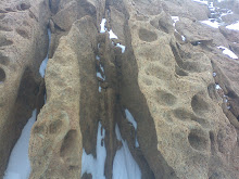
Larsemann Hills Rock Weathering
Hanging Rock
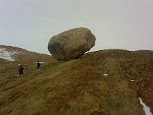
Hanging Rock Larsemann Hills and my friend behind it
Chooper
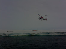
Chopper on duty
Algae
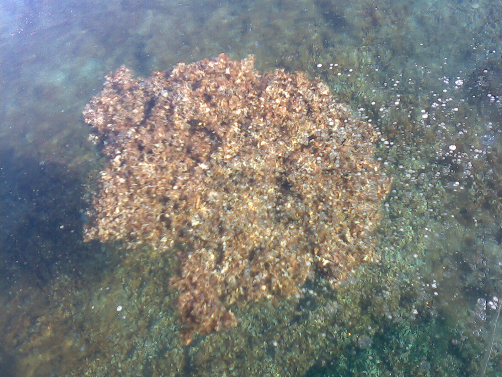
Antarctic Algal Mat
Pancake Ice
Antarctic Pancake Ice